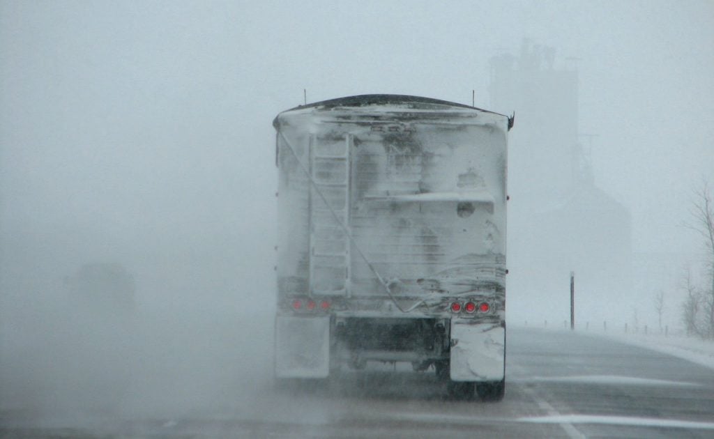
Snow is falling in many of British Columbia’s interior highways as of Wednesday, September 20th and is expected to continue.
Environment Canada has issued multiple snowfall warnings for highways in Southern B.C. and predict that it will fall through Wednesday and into Thursday.
RELATED: Snow In Coquitlam? Intense Hailstorm Leaves Residents Wondering
Snowfall was predicted along Highway 97C from Merritt to Kelowna, Highway 3 from the Paulson Summit to Kootenay Pass, and on the Trans Canada Highway from Eagle Pass to Rogers Pass according to the the forecast.
A statement read that, “Light snow has been observed on the Okanagan Connector, Rogers Pass and Kootenay Pass on previous mornings.”


Snow May Continue To Fall Into Next Week
Forecasters say that the cold weather front may even continue into next week, which could mean even more snowfall in the forecast.
Since temperatures haven’t dipped too low, large amounts are not expected to stick on the mountain passes.
With this in mind, drivers are still being warned to exercise caution when traveling on these highways during snowy weather.
The Kootney Pass is said to be hit the hardest with snowfall.
Whistler received its first dumping of powder on Monday morning and the weather forecast has been calling for snowfall in the interior since Monday.