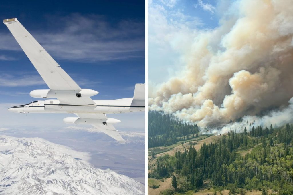
B.C. is in the middle of wildfire season right now, but what does that have to do with NASA? More than you might think, actually.
RELATED:
- Popular B.C. Resort Closes Indefinitely As Massive Wildfire Burns Nearby
- B.C.’s Wildfire Season Is Heating Up — Here’s How 2026 Compares to Recent Years
Over the weekend, NASA flew a Cold War spy plane over the blazes in order to study the massive pyrocumulonimbus clouds the fires are producing, as reported by The Canadian Press.
B.C. Wildfires Being Studied by NASA
The plane that NASA flew is called an ER-2 High-Altitude Airborne Science Aircraft, which were once used as Cold War spy planes. These aircrafts can fly twice as high as the regular altitude of commercial planes, and has set records for reaching extreme altitudes.

NASA used the plane to get a better look at those aforementioned pyrocumulonimbus clouds, which are formed from wildfires. More specifically, the clouds begin as pyrocumulus clouds that form over the top of a wildfire smoke column. Not all pyrocumulus clouds turn into pyrocumulonimbus clouds, though; in fact, only a small portion do. Researchers are continuously studying how this transition exactly happens.
The ER-2 flew over B.C.’s southern Interior more than a dozen times on Saturday, with the flight lasting over 6 hours. The plane was 60,000 feet over the Pear Lake wildfire that has been burning in the Clinton area.
“Smoky and crackling with lightning, these unique storms can create blind spots for aviators above and spark new blazes below,” NASA said in a news release.
The Pear Lake wildfire was initially discovered on July 17, 2026 and has since spread across 157,448.4 hectares. The out-of-control blaze is currently responsible for 7 evacuation alerts and 8 evacuation orders in the area.